

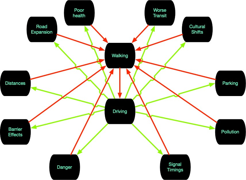
The Cycle of Unwalkability
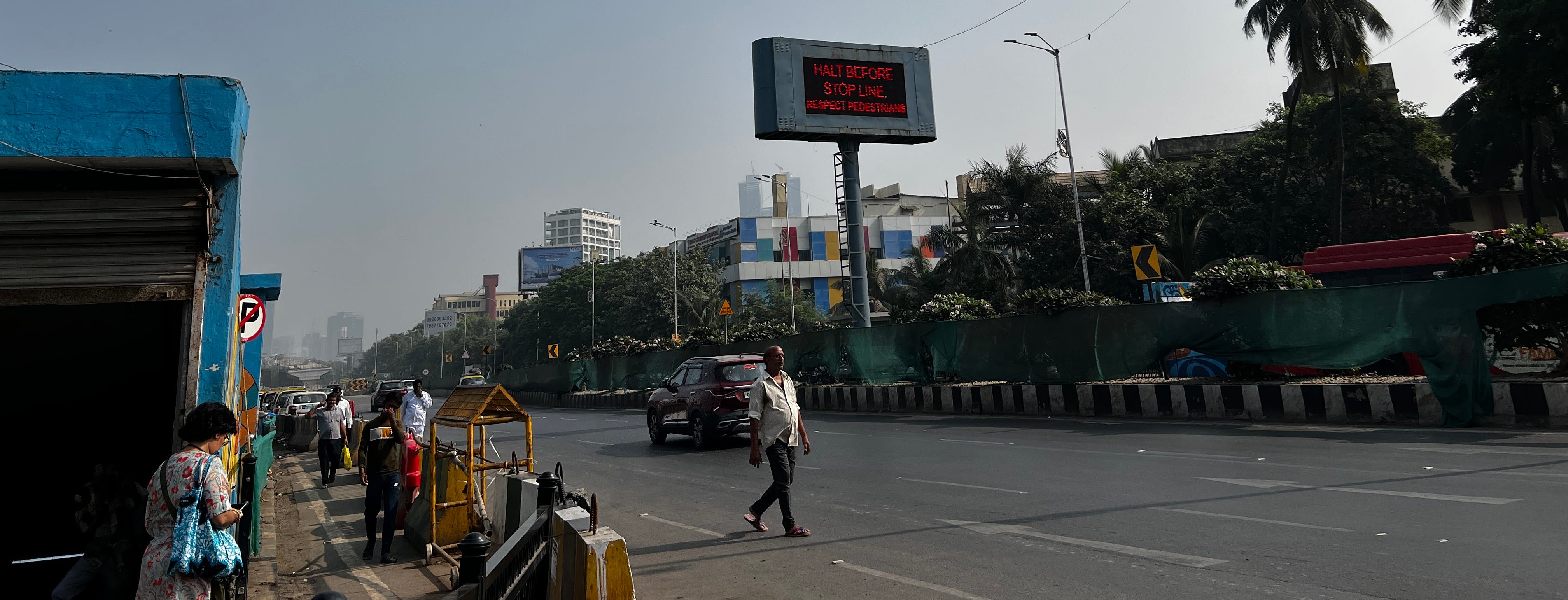
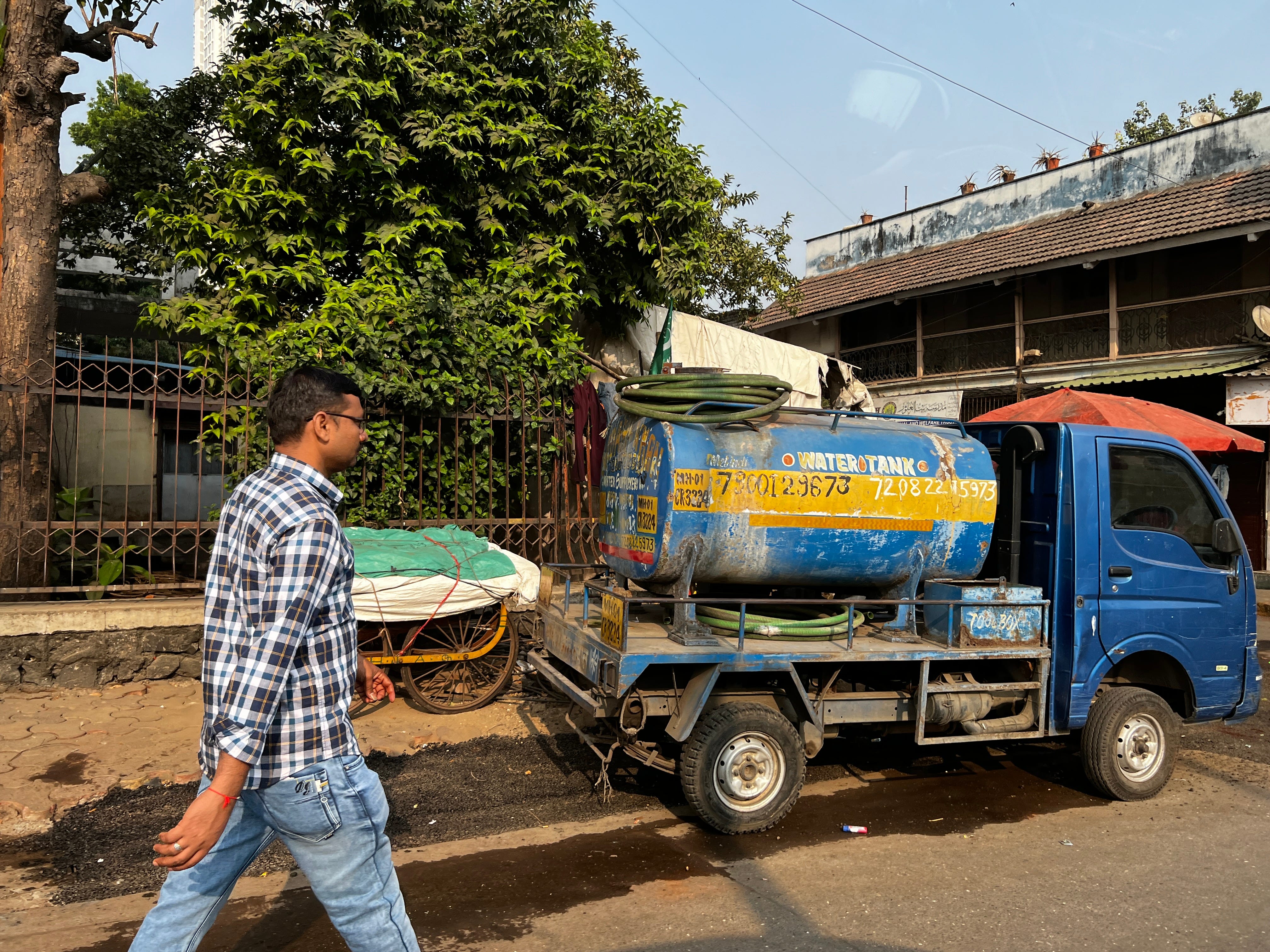
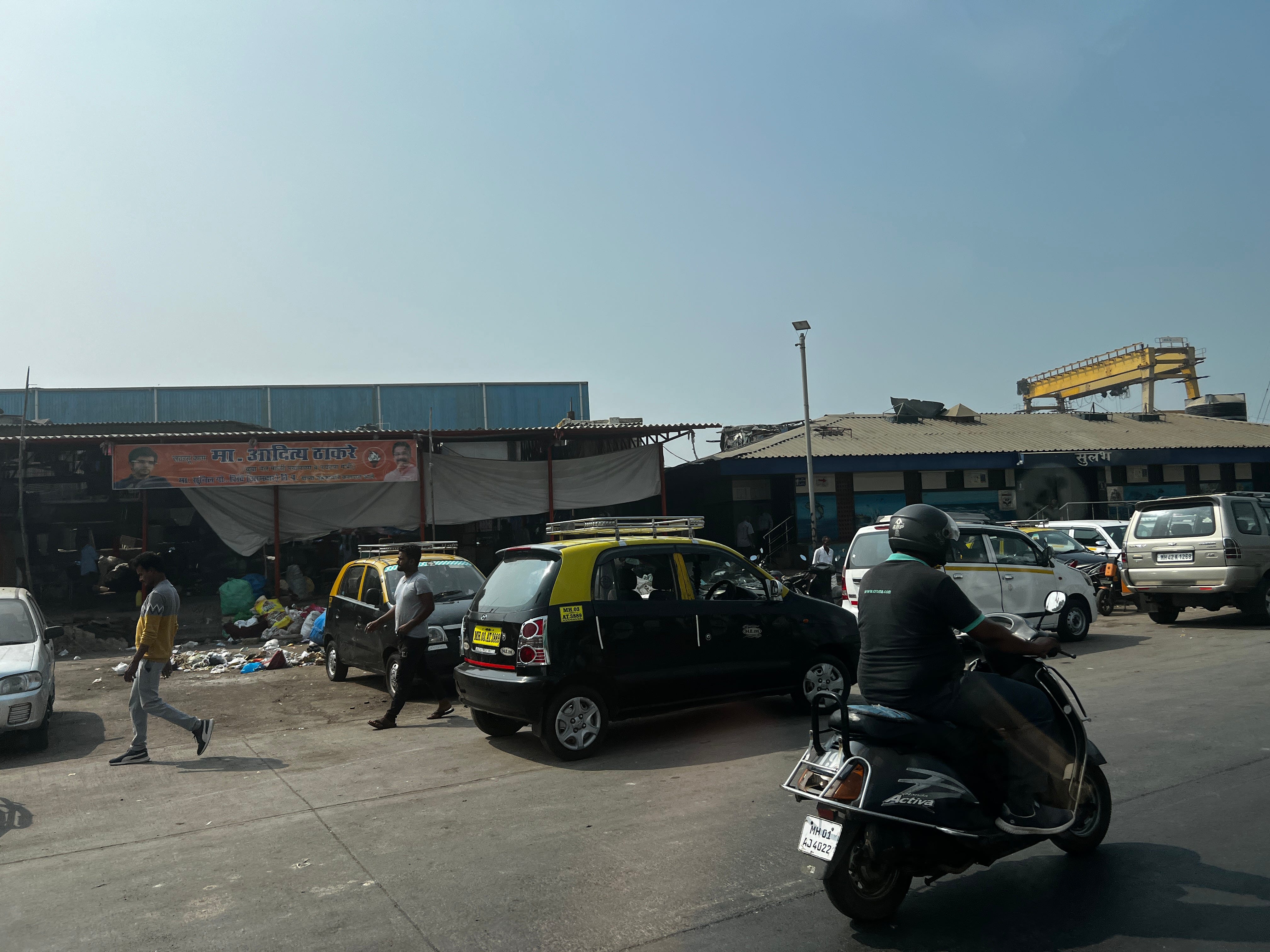
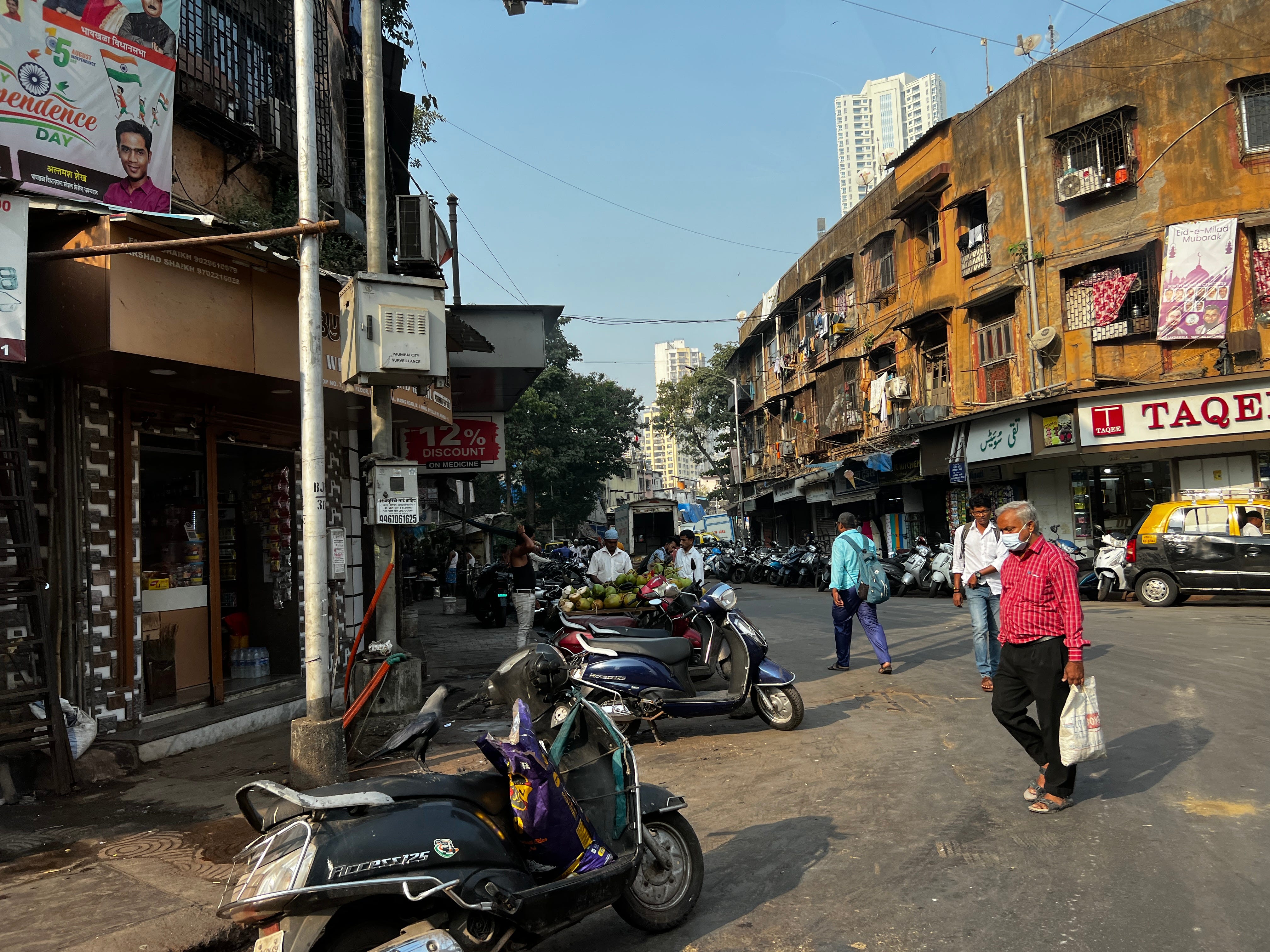
Traveling through Mumbai one notices many things. One of those things is many, many pedestrians walking in the street (or on the motorway) amidst traffic (motorcycles, three-wheelers (auto-rickshaws), cars, trucks, buses, etc.). On the one had, yay? for pedestrians for reasserting their rights and transforming the whole country into a de facto shared space. Western urban planners would salivate at the sheer number of pedestrians. On the other hand, surely there is a better way here. No one is really walking long distances if they have resources. Though lots of places are relatively close together, and there are shops and vendors on the side of the street everywhere, the expectation is that, if one has money, one uses a vehicle to get between them because walking conditions are not great. Walking is certainly not pleasant. The city is building a lot of infrastructure (Elevated Metros and Monorails as well as new freeways), but this is no European pedestrian nirvana. One looks at the side of the road, and there are only sometimes footpaths. Other times they are under construction. Often they are occupied with parked vehicles or other infrastructure for the benefit of vehicles (traffic controllers, signs, streetlights, etc.) or trash. Manhole covers are left open for unsuspecting pedestrians, as if life were a Looney Tunes cartoon. The space between a pedestrian on the street and a moving vehicle can be measured in millimetres. The horns (klaxons) blasted into your ears are literally deafening.
As WRI says:
Road traffic deaths have reached alarming levels across the world, with 1.35 million people dying in traffic accidents every year, but India’s road safety is the worst on record. Around 149,000 people lost their lives on Indian roads in 2018 alone. India accounts for about 2% of motor vehicles globally, yet it’s responsible for more than 11% of road traffic deaths.
Something is wrong here.
The Cycle of Unwalkability is a systems analysis of the conditions leading to fewer people walking. In brief, the presence of cars worsens the conditions of pedestrians. Worse conditions for pedestrians reduces walking. Reduced walking increases the use of cars. Repeat.
This operates through a number of processes.
Expansion of Roads at the Expense of Footpaths: Streets are widened to accommodate more cars, often reducing or eliminating footpaths (sidewalks).
Barrier Effect of Large Roads: Major roads and highways divide communities, acting as physical barriers that discourage pedestrian movement across different areas.
Danger to Pedestrians from Increased Traffic: The presence of more cars elevates the risk (and perceived risk) to pedestrians, making street crossing more dangerous.
Traffic Signal Timing Favoring Vehicles: Traffic lights and signals exist for the benefit of, and are optimised for, vehicular traffic, increasing wait times for pedestrians and making walking less convenient.
Pollution from Vehicles: Emissions from cars, including tailpipes, brakes, and tire wear, degrade air quality, making the walking environment less healthy.
Increased Physical Distances: Car-oriented planning and development leads to greater distances between homes, workplaces, shops, and services, making walking impractical for many daily needs.
Parking Infrastructure Consuming Space: Large areas dedicated to car parking increase walking distances and contribute to a less pedestrian-friendly environment.
Cultural Shift Towards Car Dependency: In car-centric environments, there's a cultural shift where driving is perceived as the primary and most desirable mode of transport, further discouraging walking.
Decline in Public Transit Quality: In car-dominated areas, public transportation can suffer from underinvestment, making it less accessible or reliable for those who might otherwise walk to transit stops.
Poor Health (Fitness): Less walking makes walking more difficult as the body atrophies.
The case in Mumbai is more complex and worse than this model indicates. There are enforcement problems with traffic, parking, and waste management that the west doesn’t face to the same degree. There are construction and maintenance problems associated with fast growth and missing institutions. There are many wild packs of dogs, beggars, and others consuming space. There is encroachment of shops and stalls into the footpath: Some stores and shops open up tables on the footpath, reducing the size of the footpath; others follow. Mumbai has adopted many of the forms of standardised international traffic controls (signals, markings, traffic laws, etc.), without the underlying culture that allows them to work as well as they do elsewhere (Europe, East Asia, North America (which is not to say great, but better than India). The natural response of all users of the system is to disregard (or barely regard) controls, creating a worse situation than if controls never existed in the first place, as the controls are now in conflict with the conditions on the ground. At least the speeds are low.

Prioritising safety is a philosophy, one that needs proactive introduction and maintenance throughout all layers of decision-making involved.
The staggering differences between Mumbai Metro and Mumbai Suburban Rail are clearly driven by the frameworks each system operates in, in the first place. I wonder whether anyone has attempted researching and understanding the underlying mechanisms for both of those systems in detail.
Thanks David. You make good points.
Studies listed below compare the portion of road spaces dedicated to various modes with their share of travel demands. They generally find that automobile infrastructure (higher-speed traffic lanes plus parking lanes) receives more space than fair or efficient, particularly in denser and lower-income areas where there is higher non-auto mode shares. You could also say that higher design speed, which favor faster automobile travel over pedestrian and bicycle safety are inefficient and unfair for the reasons you describe.
This is more evidence that conventional transport planning overvalues speed over other goals (affordability, safety, livability, environmental quality) compared with what is optimal.
REFERENCES
Felix Creutzig, et al. (2020), “Fair Street Space Allocation: Ethical Principles and Empirical Insights,” Transport Reviews, Vo. 40:6, 711-733 (DOI: 10.1080/01441647.2020.1762795); at https://ris.utwente.nl/ws/portalfiles/portal/276707275/Creutzig2020fair.pdf.
Stefan Gössling, et al. (2016), “Urban Space Distribution and Sustainable Transport,” Transport Reviews (http://dx.doi.org/10.1080/01441647.2016.1147101).
Stefan Gössling (2020), “Why Cities Need to Take Road Space from Cars - And How this Could be Done,” Journal of Urban Design (doi.org/10.1080/13574809.2020.1727318); at www.tandfonline.com/doi/full/10.1080/13574809.2020.1727318.
Todd Litman (2023), Fair Share Transportation Planning: Estimating Non-Auto Travel Demands and Optimal Infrastructure Investments, Victoria Transport Policy Institute (www.vtpi.org); at www.vtpi.org/fstp.pdf.
Streetspace Allocation Option Generation Tool (https://ifpedestrians.org/roadoptions/public), developed by the Centre for Transport Studies at University College London for the European Union’s MORE (Multi-modal Optimization of Roadspace in Europe).
Marie-Eve Will, Yannick Cornet and Talat Munshi (2020), “Measuring Road Space Consumption by Transport Modes: Toward a Standard Spatial Efficiency Assessment Method and an Application to the Development Scenarios of Rajkot City, India,” Journal of Transport and Land Use, Vo. 13, 1 pp. 651–669 (https://doi.org/10.5198/jtlu.2020.1526).