Mann, I. and Levinson, D. M. (2026) Fare enough: A quantitative spatial transport model for transit pricing. Transportation Research Part A: Policy and Practice, Volume 214, December 2026, 105237. [doi]
Standard transport appraisal treats fare regulation in isolation, ignoring how price signals reshape urban geography. We bridge regulatory practice and quantitative spatial economics by constructing a Quantitative Spatial Transport Model (QSTM) for Greater Sydney, endogenising household and firm locations in response to transport shocks. Our framework extends the canonical quantitative spatial model by endogenising commuter mode choice and internalising network externalities through road congestion and the Mohring effect. Evaluating three public transport pricing interventions, including zero-fare, flat-fare, and fare-cap policies, we find that free transit is welfare-suboptimal, driven largely by operator revenue losses. In our setting, distance-based fares provide a spatial price signal that helps internalise resource costs and discourage sprawl, a signal that uniform flat fares mute. The model demonstrates that allocative efficiency requires a higher user contribution, revealing that weekly fare caps function as implicit subsidies for long-distance commuters. Higher fares trigger a spatial reorganisation where residents centralise to minimise commuting costs and firms decentralise to access labour. Ultimately, efficient distance-based pricing promotes a compact residential form, encourages polycentric employment, and reduces operator resource costs.
Keywords:
Quantitative spatial models, Transport appraisal, Fare regulation, Agglomeration economies, Spatial general equilibrium, Urban economics
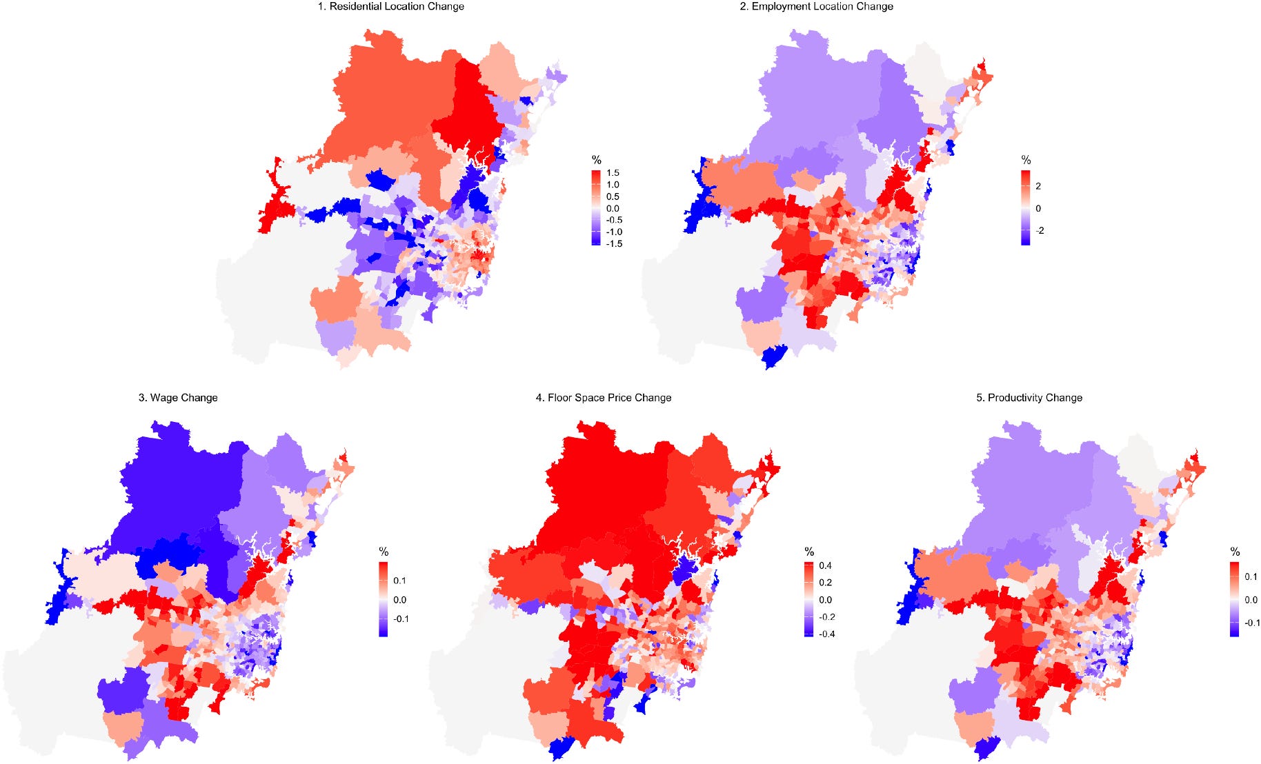
Fig. 9. Spatial reorganisation of the urban economy under removal of the weekly fare cap. The maps display the percentage deviation from the base case for residential location, employment distribution, wages, residential and commercial floorspace prices, and total factor productivity.